Ride forever.
Flow gets you
there.

Flow is navigation for electric unicycles and other personal electric vehicles. Navigate around town or across the state on your EUC with optimized routes and charge stops, so the ride doesn’t end until you want it to.
Level 2 chargers 150,000+
Countries with mapped chargers 27+
Miles ridden during testing 1,200+
EUC & PEV models profiled 36

“Will I run out before I reach a charger?”

Flow answers it ambiently — your range, your next charge, and the road ahead, readable in a single glance.
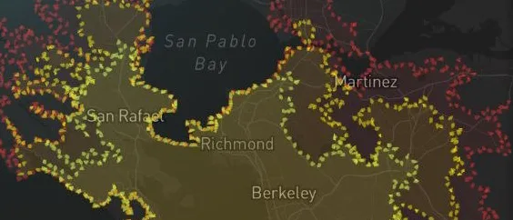
The range overlay shading the North Bay in green, yellow and red
Range

See how far you can go.

Green, yellow and red shading shows how far you can ride on your current charge.

See the range overlay
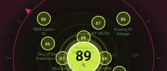
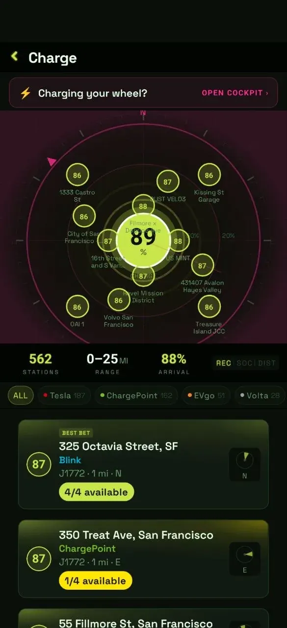
The charge radar — nearby chargers ringed with arrival battery percentages
Charge

Every charger you can reach.

The radar places each one by bearing and energy cost, color-coded by the battery you’ll arrive with.

How the radar reads
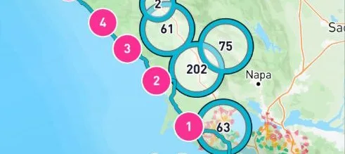
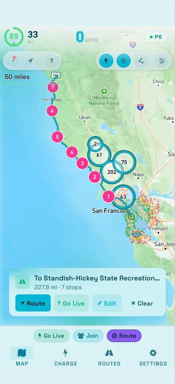
A coastal route south along CA-1 with numbered charge stops chained down the coast
Adventure

The route celebrates the ride.

Other navigation apps route you like a car or bicycle. Flow builds routes specifically for EUC, ranked for safety, scenery and efficiency.

How routes are scored
Charge

Your next charge,
before you need it.

Flow shows J1772 Level 2 chargers, RV park hookups (NEMA 14-50 and TT-30), and even ordinary 120V wall outlets — the plugs your charger already uses, and sources no other mapping app surfaces for riders. The radar scope places each one by heading and the energy it'll cost to get there. DC fast chargers (CCS, CHAdeMO, Supercharger) are excluded — they're incompatible with PEVs.

  • ✓EUC-verified chargers, flagged by the community
  • ✓Arrival-SOC bands — green, amber, red at a glance
  • ✓Tap a ping to chain it into your route
How the radar works
Flow charge radar — 562 stations, network filters, and live stall availability
Ride

Roll together.
Spectate from anywhere.

Stream your ride live to a public web map — anyone with the link watches battery, speed and distance as you roll, from any browser. Hosts stay on the road; spectators stay in the loop.
Apps needed to spectate0
Broadcast delay<2S
Explore group rides
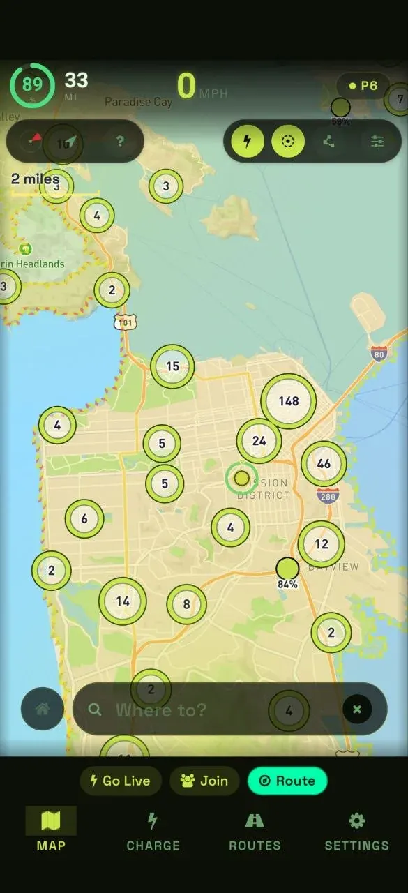
Flow map centred on San Francisco with charger clusters
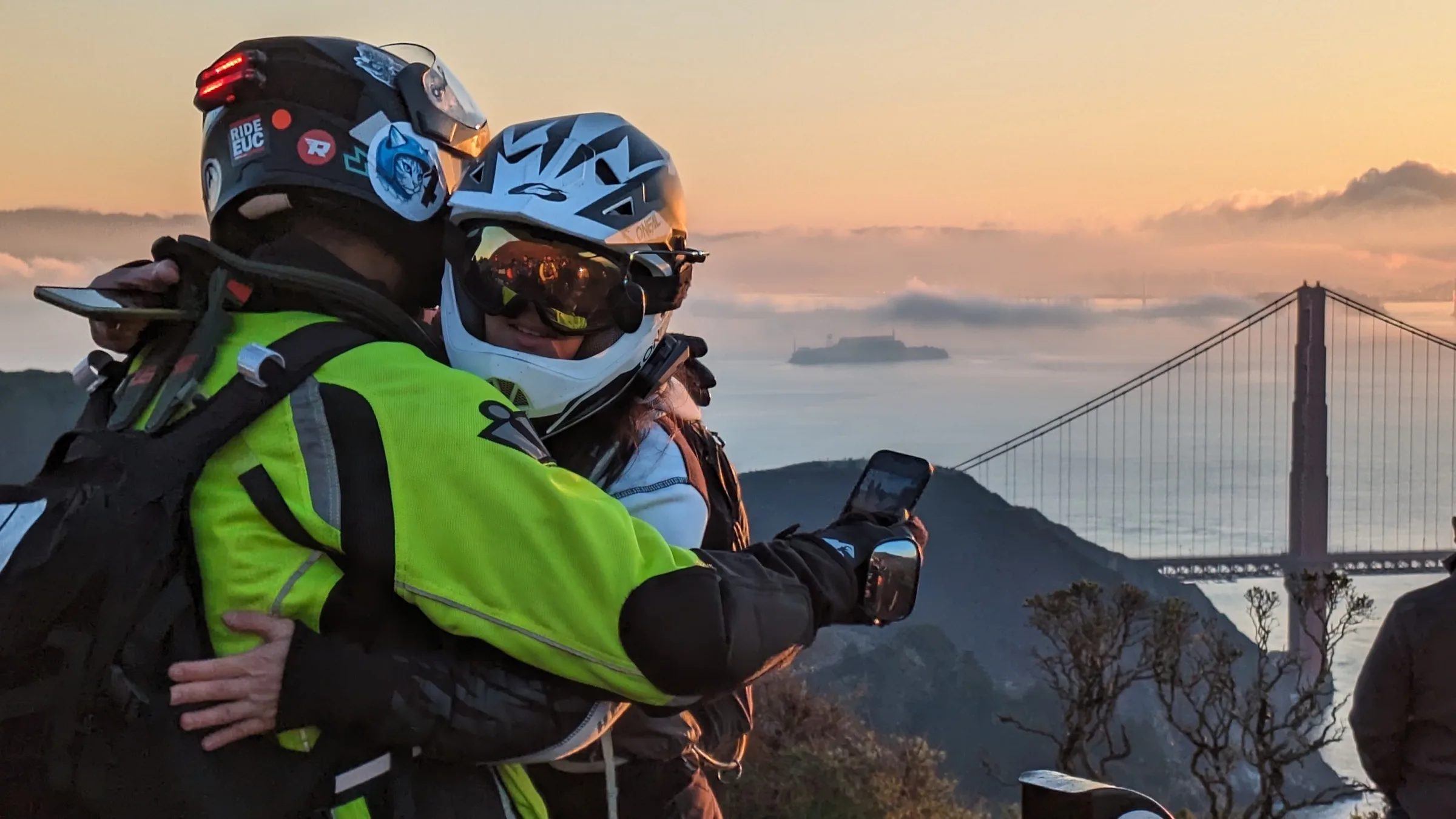
Two riders at a Marin Headlands overlook at sunset, the Golden Gate Bridge and a fog bank behind them
Connect

Your wheel,
on the dash.

Flow pairs to your wheel over Bluetooth and rides with live telemetry — battery, speed and consumption from the wheel itself, so range predictions come from your data, not a spec sheet.

  • ✓Kingsong, Begode, InMotion, Veteran & more
  • ✓Live SOC ring updated from wheel telemetry
  • ✓Runs alongside other EUC apps connected by Bluetooth
Inside the riding cockpit
A planned coastal route with numbered charge stops and speed, range and battery read-outs
Offline

No cell signal?
No problem.

Download maps before you leave. Flow caches your planned route and terrain so turn-by-turn keeps working in the Sinkyone, the Catskills, or anywhere else cell service disappears.

  • ✓Route-scoped offline tile download
  • ✓Turn-by-turn navigation stays live offline
  • ✓Auto-offered for routes over 50 miles
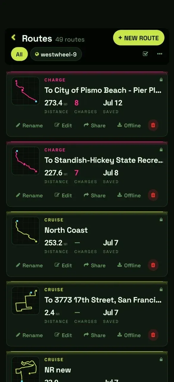
Plan it and take it offline
Saved routes library showing cruise and charge routes with offline download

The ride doesn't end when the roads do.

Download Flow and turn the impossible route into your next weekend.
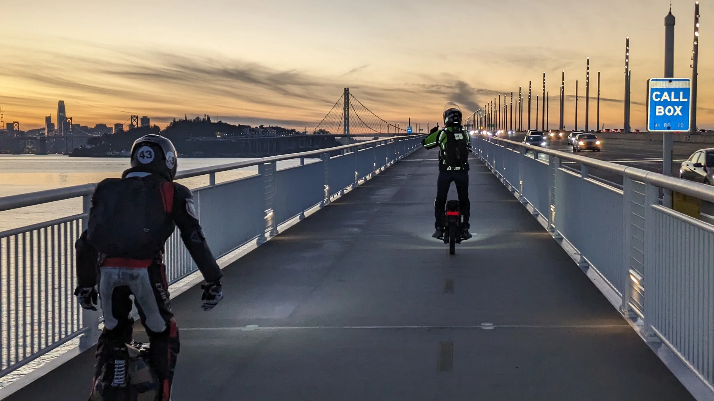
Two EUC riders on the Bay Bridge bike path at sunset, the San Francisco skyline ahead